.png)
Harnessing MetOcean Intelligence to Safeguard the Archipelagic Frontier
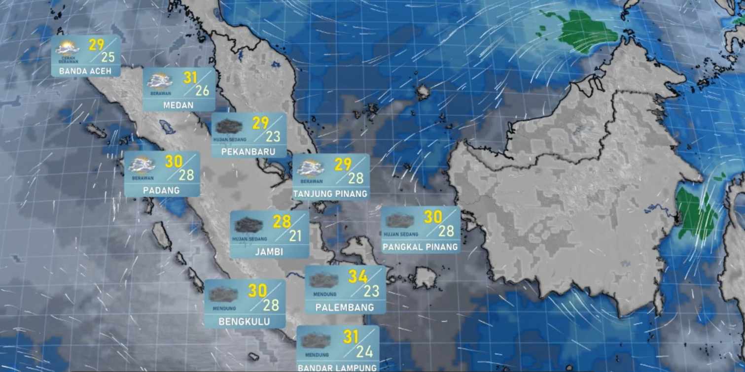
Vast maritime territories demand unmatched oceanographic intelligence. Inspired by global industry pioneers like CLS, SIBAKOM engineers and deploys next-generation Maritime Meteorology infrastructure to secure shipping lanes, defend offshore energy assets, and shield coastal communities across the region.
The Strategic Imperative: Why Advanced Maritime Technology is Vital for Indonesia and ASEAN
The geographical and meteorological realities of Indonesia and the broader ASEAN region create an environment where advanced maritime tracking is not just an asset, it is a critical necessity.
- The Cause: Indonesia spans an immense archipelagic territory comprising over 17,000 islands characterized by highly volatile marine micro-climates, shifting surface currents, and intense interaction with tropical weather systems.
- The Complication: Traditional land-based meteorological stations are completely isolated from open-ocean dynamics, leaving huge blind spots regarding offshore wave heights, sudden marine squalls, and deep-sea pressure anomalies. Consequently, fleet managers, traditional fishermen, coastal cities, and offshore oil rigs are left highly vulnerable to unpredicted severe sea states, frequently resulting in tragic maritime accidents, disrupted global trade corridors, and severe economic losses.
- The SIBAKOM Impact: To neutralize this regional vulnerability, SIBAKOM has pioneered hyper-local, fully integrated marine observation and modeling infrastructures. As a direct result, raw oceanic data is instantaneously converted into high-definition, actionable forecasts down to an exact island scale. This empowers maritime industries and national agencies to completely out-maneuver severe weather traps, turning highly volatile waters into highly predictable, safe, and optimized transit networks.
Core Pillars of SIBAKOM’s Elite Maritime Solutions
Through our longstanding strategic partnerships with global leaders like Baron Services, SIBAKOM provides turnkey, end-to-end meteorological and oceanographic surveillance networks built to withstand the harshest aquatic environments on Earth.
1. High-Performance Moored Buoy Networks
We supply and strategically anchor heavy-duty, autonomous moored buoy stations across critical deep-sea and coastal zones.
- Autonomous Telemetry: Each floating station operates independently and relies on secure Iridium satellite telemetry to continuously beam live data streams back to command centers on shore.
- Comprehensive Sensor Payloads: The buoys measure real-time Sea Surface Temperature (SST) and Salinity to identify oceanic shifts and thermal potential.
- Dynamic Wave Analysis: The systems conduct full directional wave spectrum analysis alongside monitoring surface wind speeds, sudden gusts, and shifting barometric pressures.
2. Advanced Coupled Atmospheric Marine Modeling (MMS Platforms)
True precision requires looking at the ocean and the sky as a single, interconnected machine. SIBAKOM implements sophisticated numerical physics to model this reality.
- The MMS Framework: Developed as a cornerstone of major national meteorological projects like MMS1 and the upcoming MMS2 expansion, the Baron Coupled Atmospheric Marine Model delivers elite, high-resolution marine predictions.
- Island-Scale Hydrodynamics: Our high-resolution models map complex surface ocean currents directly at the island scale, giving unprecedented clarity to localized coastal movements.
- Cyclonic Tracking: The system charts ocean potential temperatures to assess the immediate forecast impact of tropical cyclones and severe marine low-pressure systems.
- Tropical Forecast Foundations: This highly advanced modeling framework supplies the vital core data required to fuel dedicated, national-level Tropical Forecast Centers.
3. Precision Marine Safety & Intelligent Vessel Routing
Data is only valuable if it drives successful operational decisions. SIBAKOM provides the analytical software layers that turn raw marine metrics into safe navigation routes.
- Fuel & Safety Optimization: Our routing algorithms allow commercial fleet managers and shipping operations to optimize fuel efficiency while proactively steering vessels completely clear of hazardous sea states.
- Coordinate-Specific Alerting: The platform broadcasts automated severe weather and wave warnings tailored to specific geographic coordinates to keep crews instantly informed.
4. Eco-Disaster Mitigation & Tsunami Early Warnings
Our maritime installations serve as an essential shield against large-scale environmental and tectonic catastrophes.
- Tsunami Interception: By seamlessly integrating deep-ocean bottom pressure sensors into our offshore networks, we facilitate rapid data feeding for national tsunami early-warning systems.
- Oil Spill Trajectory Modeling: In the event of an offshore industrial leak, our software utilizes real-time surface current data to instantly model the trajectory of oil spills, allowing containment teams to act before ecological barriers are breached.
SIBAKOM stands uniquely positioned as the premier System Integrator for Environmental Solutions across Indonesia. Our track record includes over two decades of robust partnership with Indonesia's national meteorological agency (BMKG), successfully building out extensive networks of advanced weather radars and marine modeling systems.
By merging world-class hardware with intuitive, interactive visualization software, we deliver lifesaving clarity to the maritime industries, national agencies, and coastal communities that depend on the safety of our waterways.
Command the Seas with Confidence. Secure Your Maritime Horizons with SIBAKOM.
.png)